
Surveying Scouts Come to Clark
Scouts of America learn about surveying from Clark faculty and students
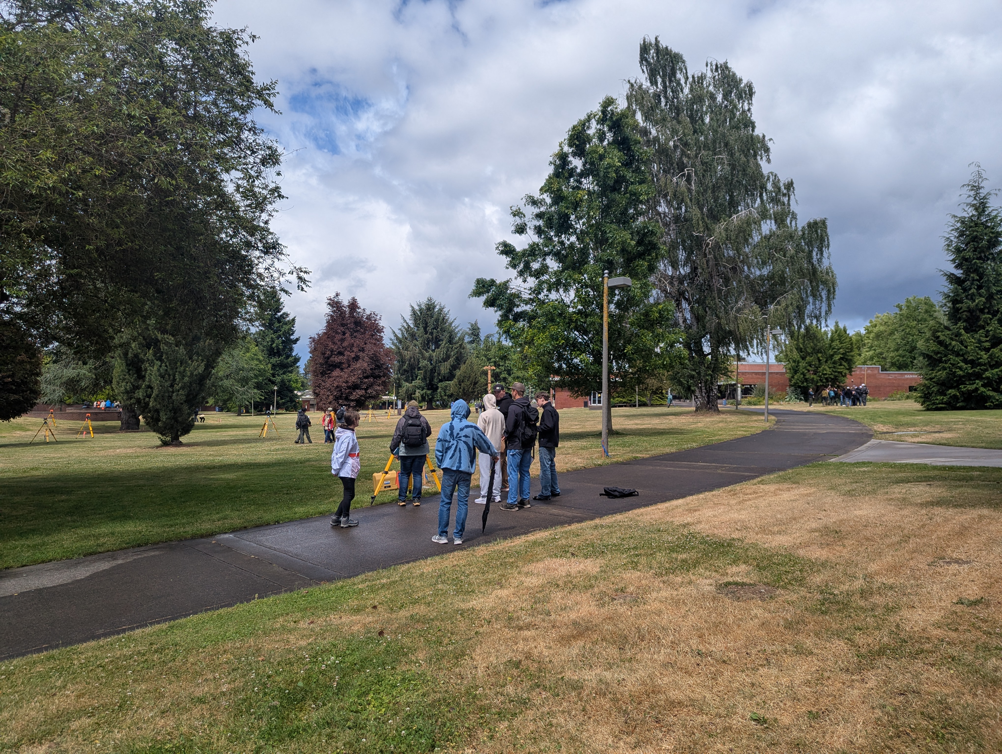
The Scouts of America recently visited Clark College to learn about surveying and earn their survey merit badges. The full-day class, hosted on Saturday, June 6, welcomed more than 50 middle and high school scouts along with troop leaders and parents.
Professional Land Surveyors from Oregon and Washington joined Clark faculty and students to assist with instruction and field exercises, including classroom instruction, the exploration of survey careers, and what the future of surveying might look like.
Scouts also received hands-on experience by participating in three field exercises, during which they used surveying tools such as total stations, commercial GPS units, and automatic levels. The equipment was provided by the college and set up by Clark students and faculty so that multiple groups could participate simultaneously.
In one exercise, a five-sided polygon was marked out on the ground. Scouts used a total station on one corner of the polygon. From that location, they measured the distance and angle to the polygon’s remaining four corners.
The scouts were also tasked with taking measurements of five other features near their lot. Three of these five features were then measured with a GPS unit to determine their positions so that they could compare various distance measurements.
Then, the scouts used an automatic level to measure the elevation for each polygon corner, basing their calculations on a known elevation. With all their information collected, the scouts sketched a map of the polygon and features with all the correct distances, angles, and elevations.
The day was a huge success — not only did the scouts earn an important merit badge, but they also engaged Clark’s students by asking specific questions about surveying and showed a deeper interest in the field.
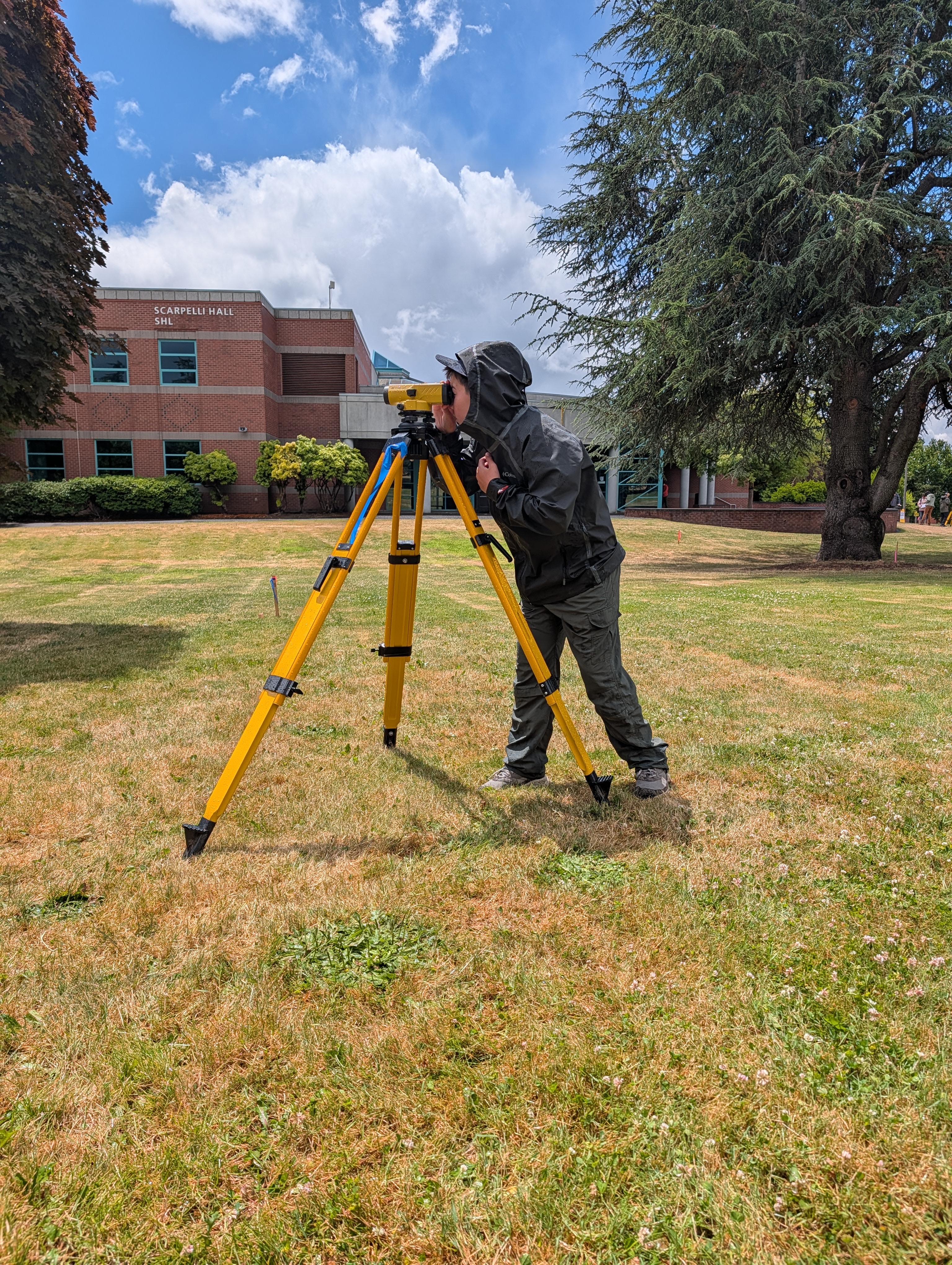 Pictured: Scout uses a total station
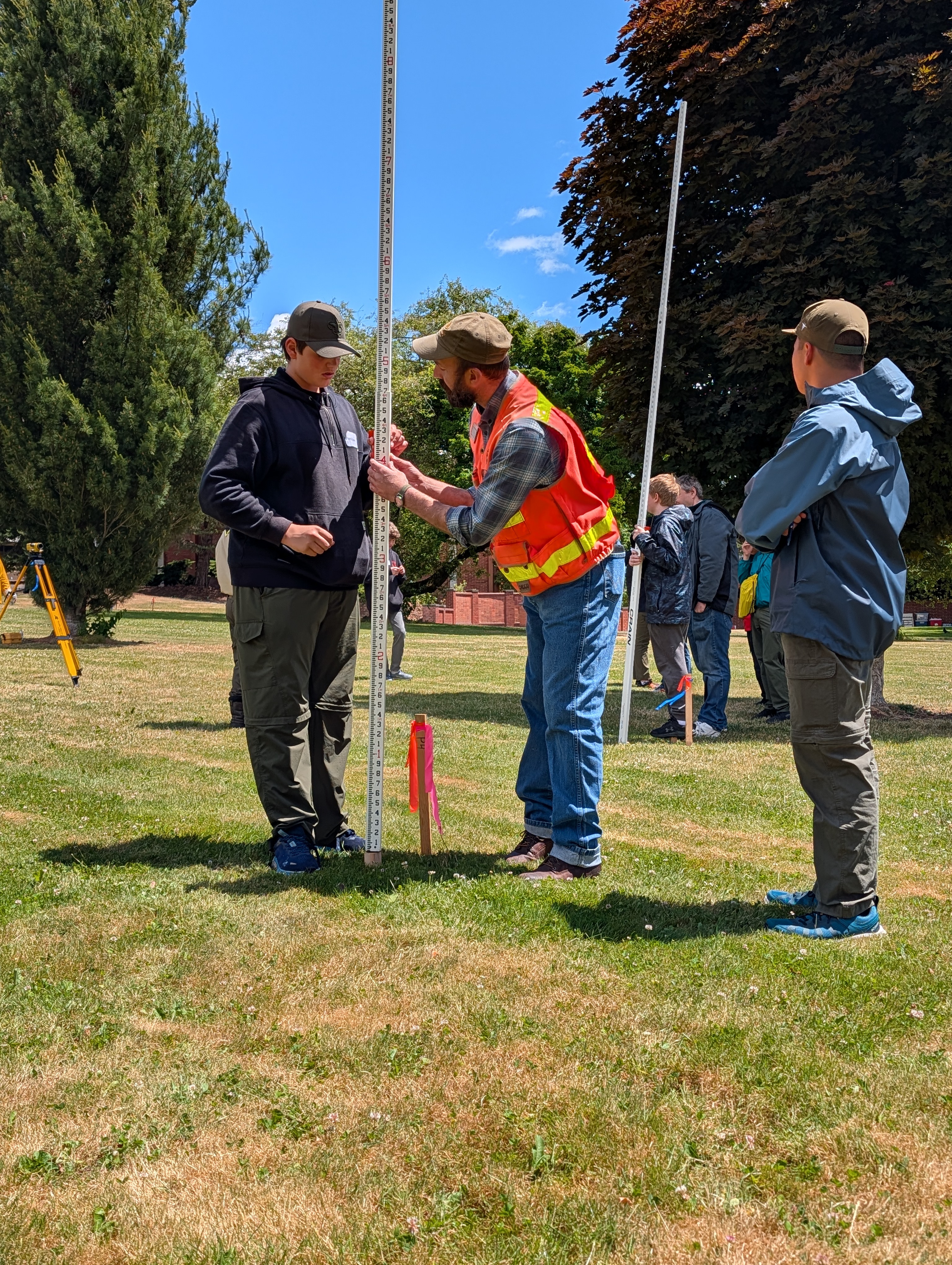 PIctured: Scout uses a grade rod to measure elevation
About Surveying and Geomatics and Clark
Surveying and Geomatics involves the accurate assessment, measuring, and plotting of land and water boundaries for development projects that include buildings, roads, and bridges. Clark’s program uses state-of-the-art land surveying equipment and techniques used in real-world situations to prepare students for entry-level work in government and private sector roles. Clark offers an associate in applied science degree that provides training in survey techniques and methods. The course curriculum prepares a student for entry-level work or transfer for a bachelor’s degree.
Photos: Clark College/Brian Miyake
Story by Professor Brian Mikaye, Surveying and Geomatics